

Geoinformatics and geomatic engineering
Geographic Information System (GIS)
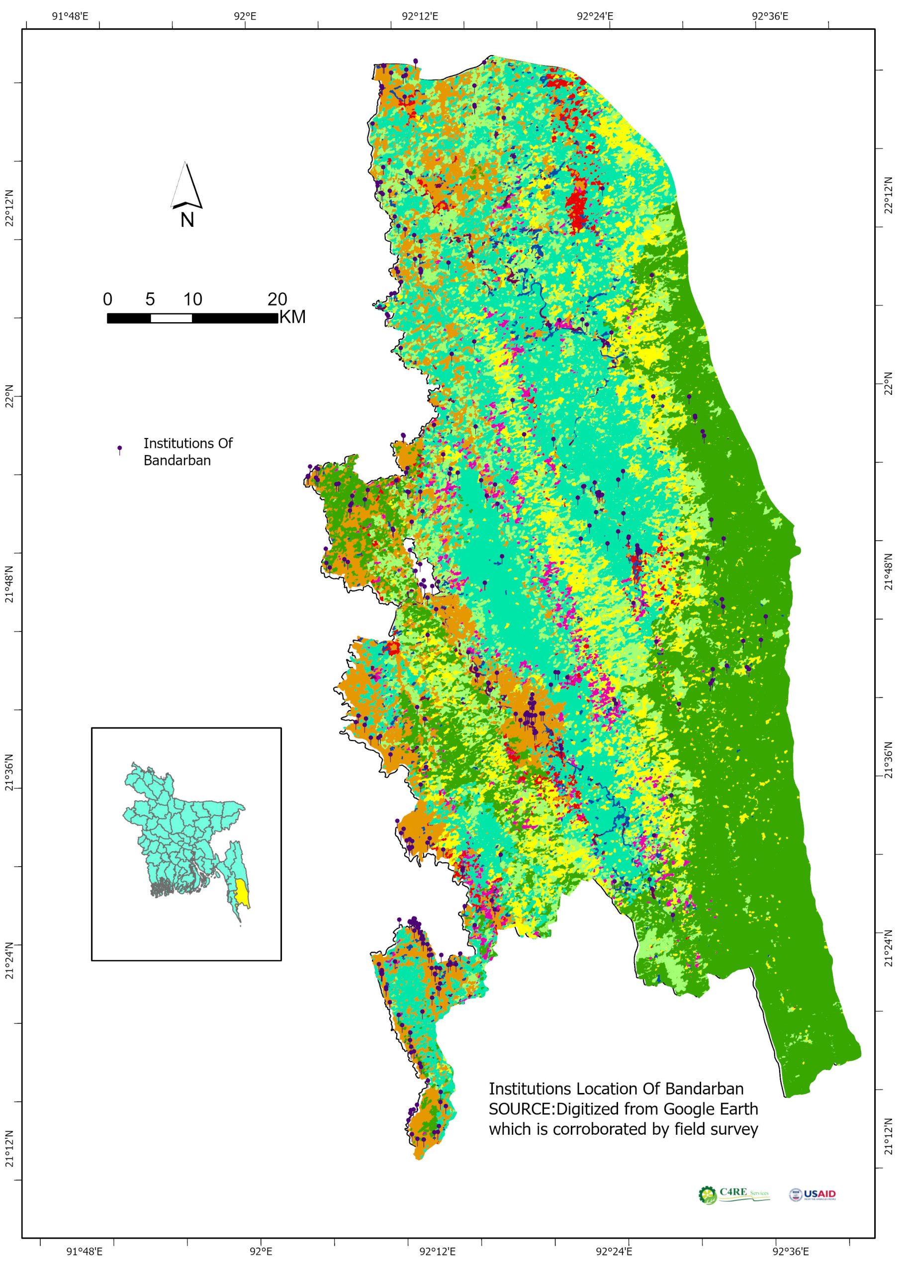
Applies geospatial technology in diversified fields including natural resource management, environment, climate, hydrologic and hydrodynamic modeling, and so on. It provides services for the development, integration, and analysis of geospatial databases, development of DEM, desktop/web-based geospatial applications, web-based LIS, and other web GIS. It also conducts various digital surveys including RTK, Total Station and DGPS Survey as well as provides customized GIS training for the clients.
Area of Expertise
- GIS Mapping and spatial analysis
- GIS-based application development
- GIS-enabled web mapping and geospatial solution
- GIS-based MIS and Decision Support System (DSS) development
- Digital mapping and real-time database development for utility services such as gas, electricity, and road network
- Land use and land cover mapping and change detection
- Develop clutter data and vector-based 3D building model for telecommunication
- Disaster monitoring and damage assessment in Near Real-Time (NRT) mode
- Digital Elevation Model development from various sources of data
- Prepare a GIS-based Land Ownership Database for land acquisition and resettlement planning
- Multi-hazard and vulnerability mapping and disaster risk assessment
- Develop GIS-enabled web mapping and geospatial solutions for Decision Support System
- GIS Software:
- PC Arc Info
- ArcView GIS
- ArcView Spatial Analyst
- ArcView Image Analysis
- ArcView 3D Analyst
- ArcView Network Analyst
- Arc GIS
- Atlas GIS
- IDRISI
Hardware of GIS Division
- Server (Pentium-lV)
- Personal Computer (Pentium-lll)
- Digitizer (A0)
- Plotter
- Color Printer (HP DeskJet – 9650)
- Scanner
- Lan (All PC)
- GPS (MAGELLAN ProMARK X CM, Garmin )
Remote Sensing (RS)
Some projects require the acquisition of information on objects and phenomena at a large scale. Physical survey in such a situation is not a viable option. Remote sensing is a technique that is time and cost-effective and is therefore apt for such projects. The services ensure accurate and cost-effective data collection which is an important input for planning and designing of mapping projects. C4RE Services' expertise in remote sensing branches out to meet classification, image correction, image enhancement, image processing, and change detection services from satellite/airborne data collection platforms. These services are rendered as per the project’s requirements. The remote sensing services by image processing (RADAR/optical/hyperspectral/drone) create data to analyze and compare data of forestry, weather, vegetation, pollution, erosion, land use discerning patterns or trends in socio-economic or natural resources or ecosystems. The remote sensing services offered can are an integral part of city planning, military observation, strategic defense planning, border patrolling, border monitoring, archaeological investigations, and so on.
Produces land cover and land use data, natural resources mapping, change detection mapping, erosion-accretion mapping, flood inundation mapping, agricultural crop mapping, environmental impact assessment mapping, and clutter data for wireless telecommunication network planning using state-of-the-art technologies currently achieved in the remote sensing field. It also offers basic and advanced training on optical and radar satellite image processing and applications using Erdas Imagine and Google Earth Engine.
Area of Expertise
- Satellite image processing
- Land use/land cover classification
- Monitoring & and damage assessment of Disasters including flood & and erosion
- Analysis of spatial and temporal data derived from satellite images